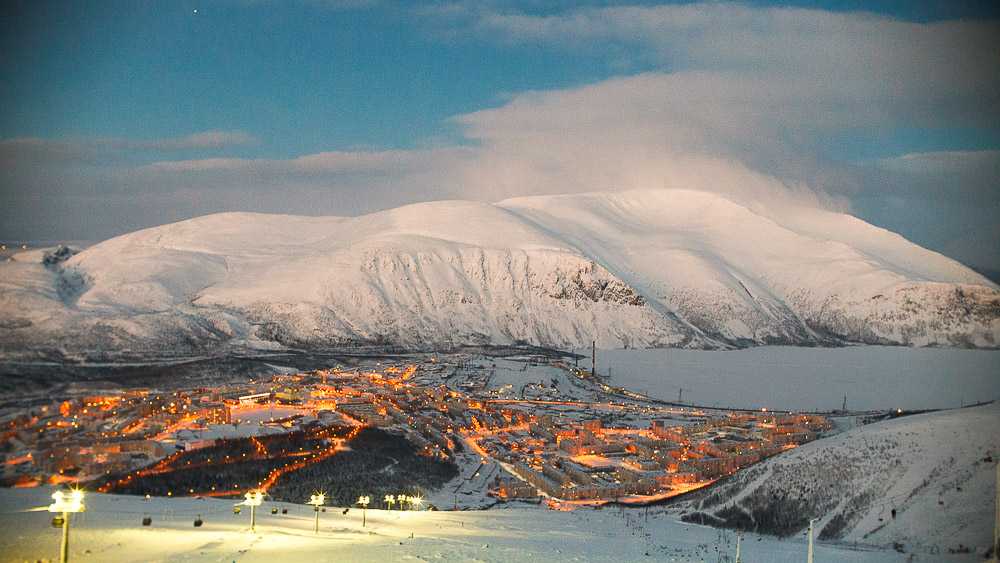
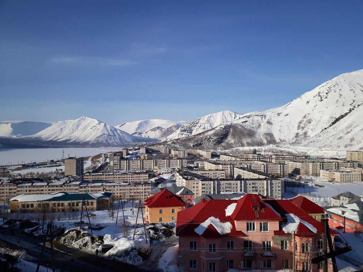
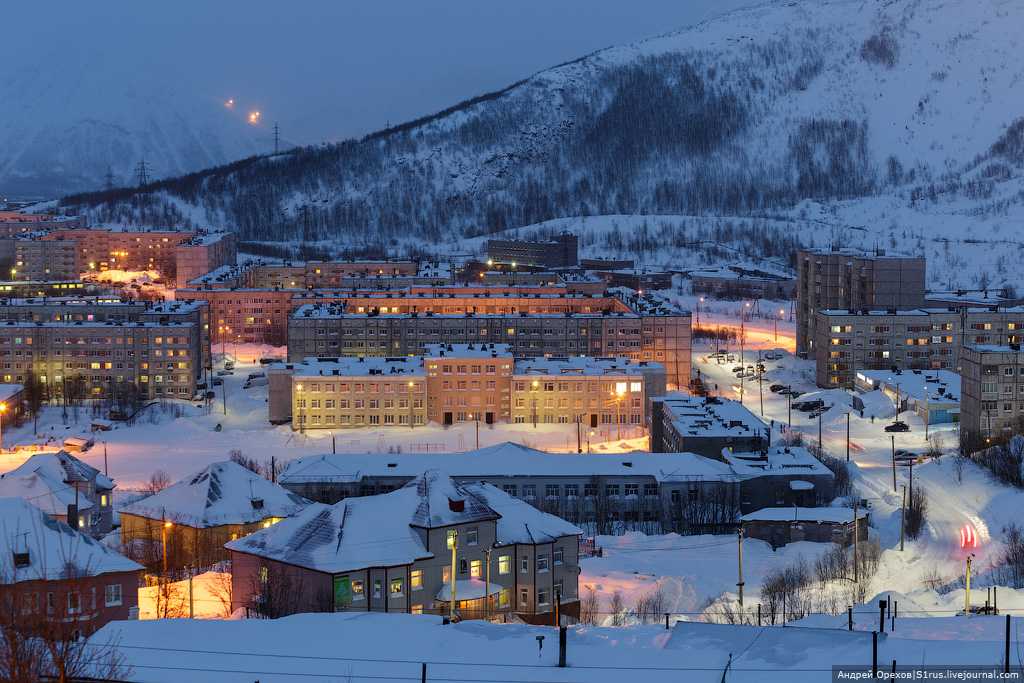
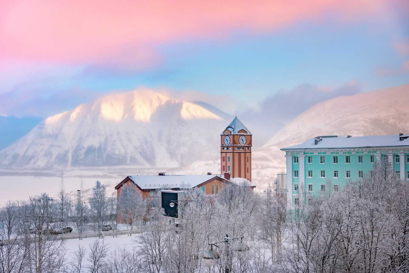
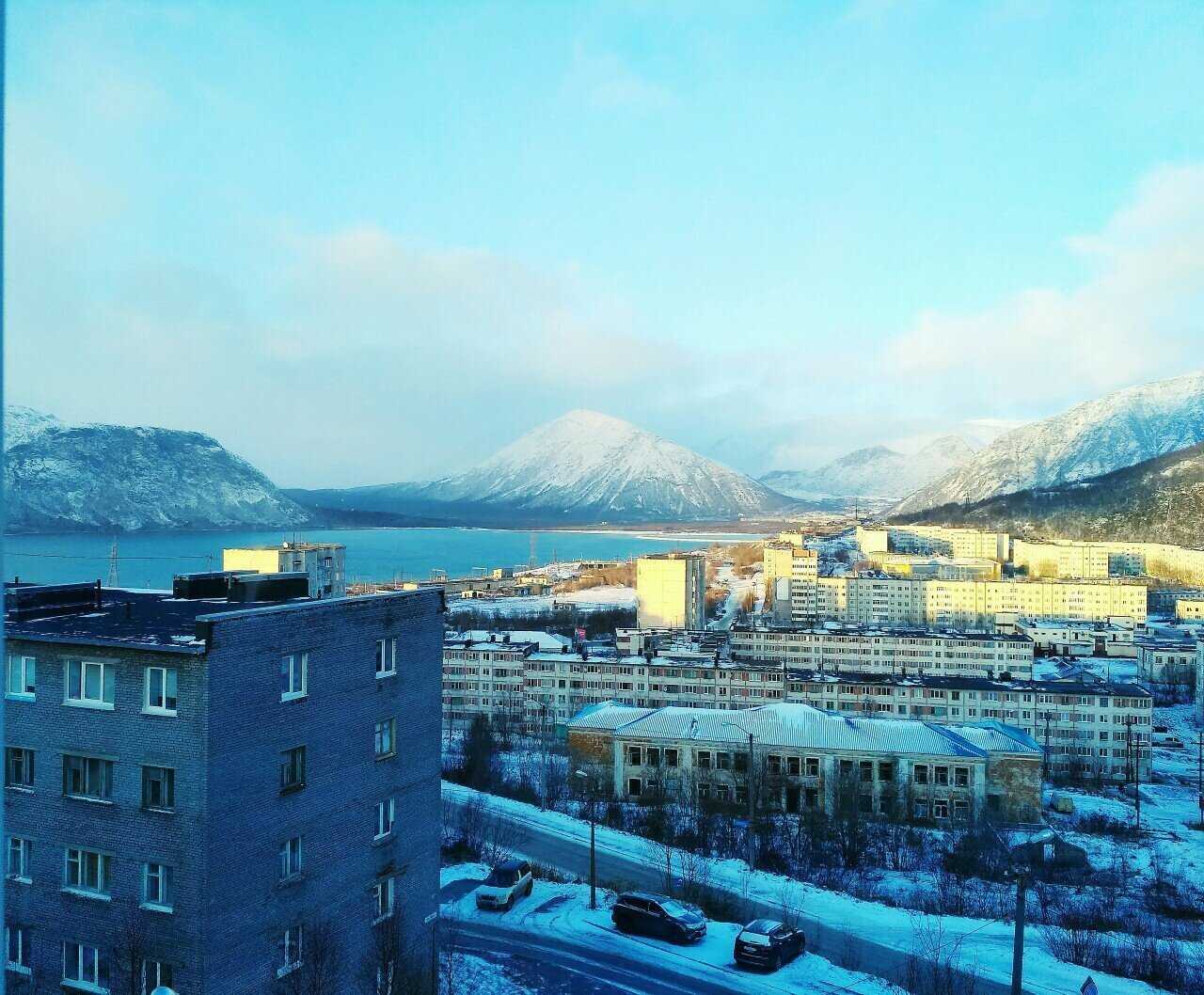
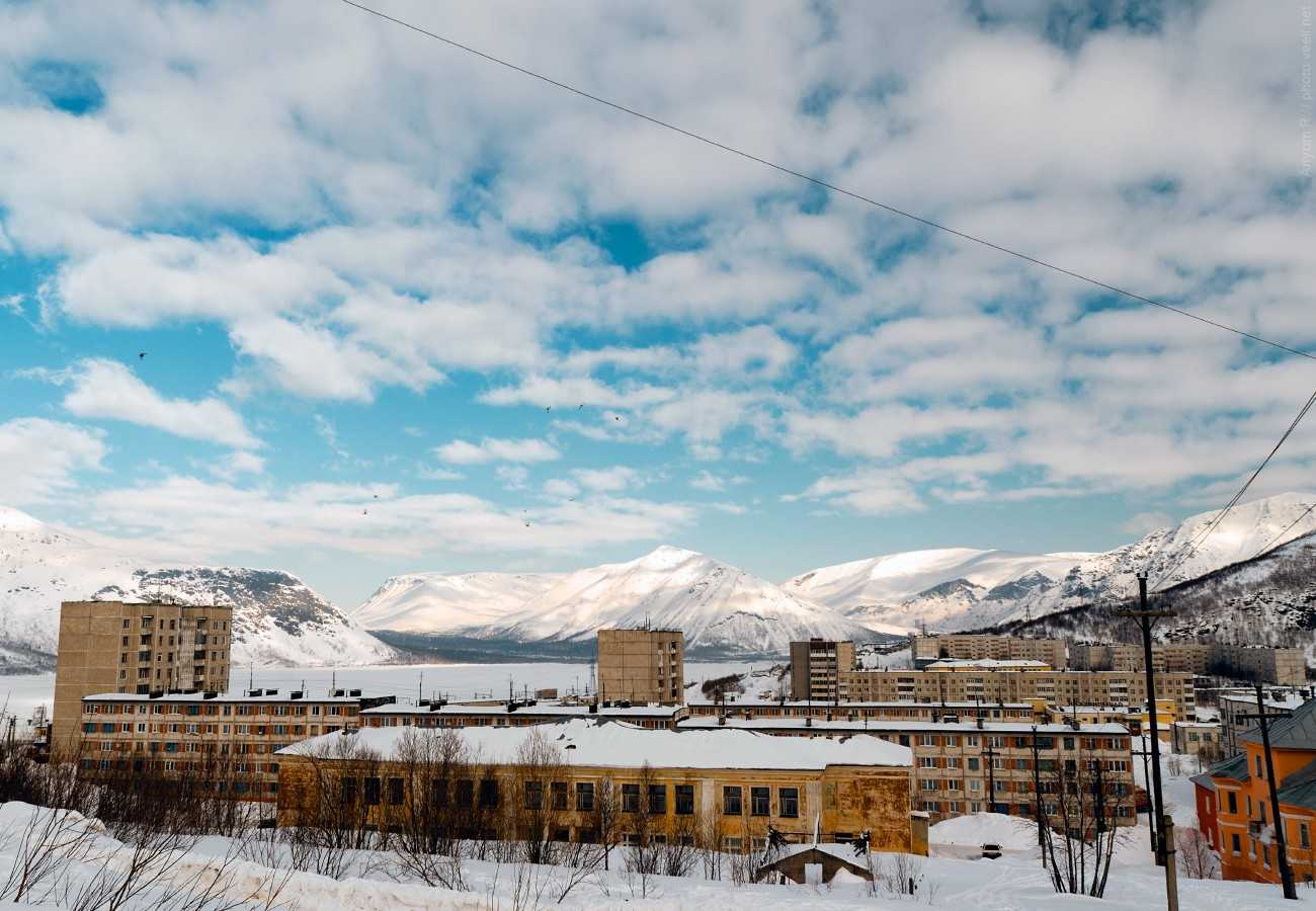
Как одеваться, какие взять вещи
Погода в целом будет описана ниже, забегая вперед можно отметить, что она в основном прохладная. Как-никак это Заполярье.
На выбор одежды наверняка повлияет вид, выбираемого вами отдыха, будут ли это горнолыжный отдых или экскурсии по местным достопримечательностям.
Если вы едете сюда за тем, чтобы вдоволь накататься по склонам Хибин, то берите самые теплые вещи, что у вас есть.
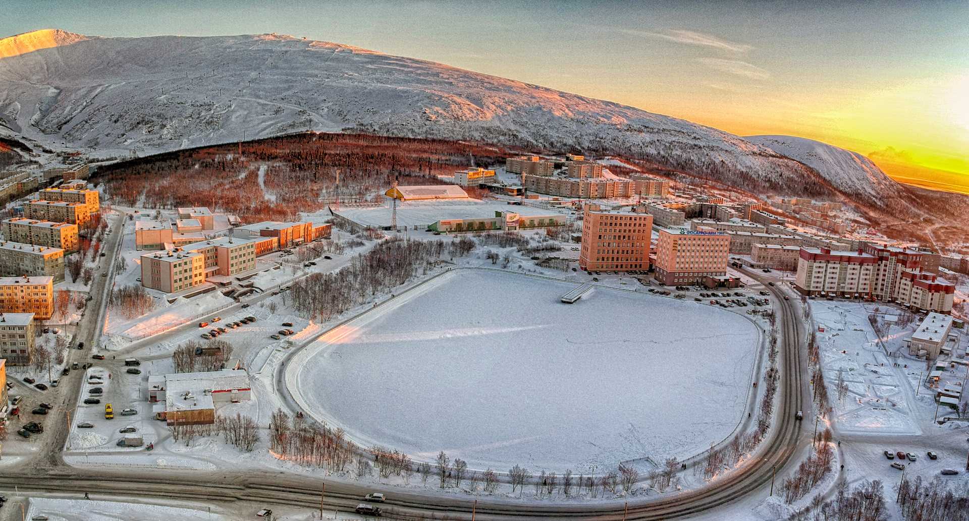
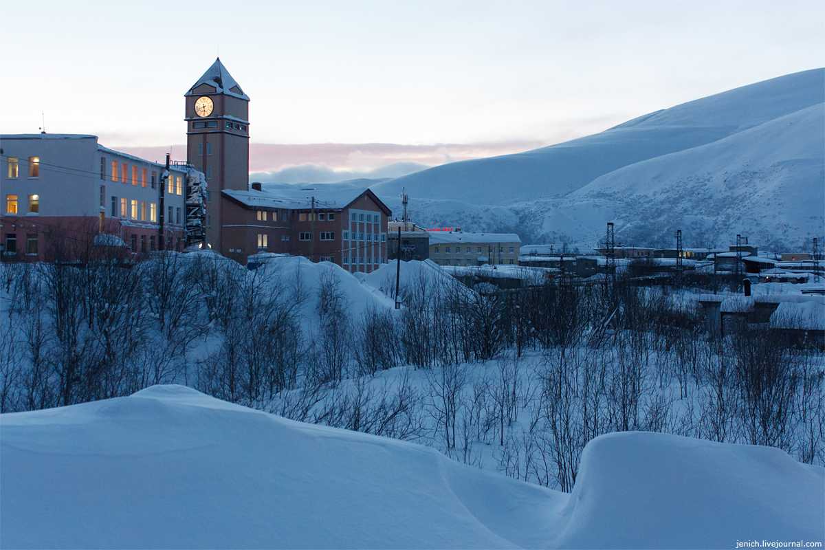
Зима
В такое холодное время года средняя дневная температура равняется -14°C. А в целом колеблется от -32°C до -1°C.
Ночная температура в принципе сопоставима с дневной — в среднем -15°C. Амплитуда между -33°C и -2°C.
Погода весьма облачна, в среднем две с половиной недели на месяц. И около 9 дней в месяц — это осадки. Впрочем, снег зимой, это как раз то, что нужно. К тому же, несмотря на частоту осадков, зимой выпадает наименьший объем осадков.
Весна
Весна тут значительнее теплее. Днем в среднем +2°C, ночью 0°C. Максимальная температура подскакивает аж до +16/+13 °C соответственно. Впрочем, ночи продолжают оставаться довольно холодными, порой в минимуме температура может опускаться до -16°C днем и до -26 °C ночью.
Весной тоже преобладают облачные дни – две с половиной недели на месяц. Неделя уходит на осадки. Объем осадков наибольший в году.
Лето
Лето довольно теплое, легко даже забыть, что вы на севере. Дневная температура в среднем держится на +17°C, ночная на +14°C.
В самые теплые часы тут почти жара — +28°C/+25°C соответственно. И только самые холодные дни напоминают, где вы находитесь. Самая низкая дневная температура +9°C, ночная +5°C.
Летом больше всего ясных дней — 8 на месяц, и меньше всего облачных — они занимают полмесяца. Объем осадков чуть менее весеннего.
Осень
Средняя температура в целом соответствует весенней +1°C/-1°C, днем и ночью соответственно.
Но в целом, осень все же прохладней. Температура максимум достигает +14°C днем и +8°C ночью. А вот опускаться может уже до -28°C, в независимости от времени суток.
Осенью наименьшее количество ясных дней — в среднем 2 на месяц. А количество дней с осадками наибольшее — 12 на месяц. Объем выпадающих осадков среднегодовой.
Основные подготовительные мероприятия
Перед поездкой на курорт необходимо узнать о климате и погоде в регионе, чтобы подготовиться к отдыху. В зимнее время температура на горных склонах может значительно отличаться от температуры в долине, поэтому необходимо взять с собой теплую одежду и обувь.
Также важно правильно выбрать лыжи и другое снаряжение для горнолыжного отдыха. При выборе лыж нужно учитывать наклон склонов и свой уровень подготовки
На курорте обычно можно арендовать все необходимое снаряжение.
Во время отдыха обязательно стоит уделить внимание досугу, который предусматривает курорт. Это могут быть прогулки по горам, экскурсии, катание на санях и прочие развлечения
Техническое обслуживание оборудования в горнолыжных курортах
Горнолыжный отдых – это не только активный досуг, но и ответственность перед собой и другими гонщиками. Большую роль в этом играет состояние лыж и сноубордов. Техническое обслуживание оборудования в горнолыжном курорте – это неотъемлемая часть заботы о безопасности и удобстве катания. Каждый гонщик должен не только следить за состоянием своих лыж, но и проверять общее состояние техники на прокатных станциях.
- Наклон склона, состояние снега и климат – это факторы, которые могут повлиять на состояние лыж.
- Погода, температура и особенности гор под воздействием катания – это факторы, влияющие на износ оборудования.
Чтобы избежать неприятностей во время катания, гонщикам нужно следить за техническим состоянием лыж и проверять их перед каждым спуском. Гонщик должен знать, как чистить лыжи от налета и следов снега, каким образом правильно затачивать кромки, как выбирать ленту и устанавливать крепления.
Определение своего уровня катания
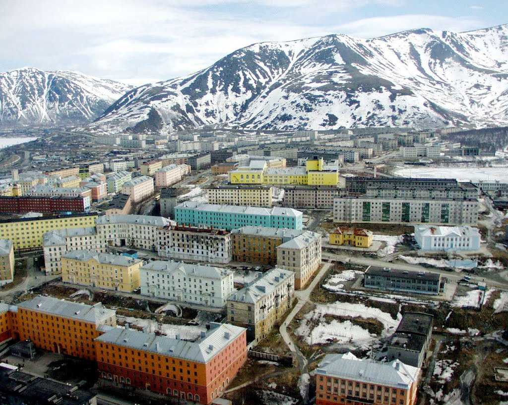
Кировск — это прекрасный курорт для любителей горнолыжного отдыха. Климат и сезон сделают его по-настоящему уникальным местом. Но прежде чем отправляться на курорт, необходимо определить свой уровень катания.
На Кировском курорте у вас будет возможность выбрать лыжи в соответствии со своим уровнем подготовки. Здесь есть лыжи для начинающих, промежуточных и профессиональных спортсменов. Кроме того, вы можете арендовать лыжи на месте, что удобно и экономично.
Температура и наклон склона также являются важными факторами при выборе своего уровня. Новичкам следует выбирать участки покруче, а профессионалам – более крутые склоны.
Не забывайте о погоде! Она может значительно повлиять на планируемый досуг. Поэтому, перед выездом на курорт, обязательно узнавайте прогноз погоды.
Важно помнить, что на горных склонах всегда есть определенный процент риска. Поэтому, чтобы ваш отдых был максимально приятным и безопасным, определите свой уровень катания заранее
Выбор инструктора
Во время горнолыжного отдыха в Kировске важно учитывать, что выбор инструктора является ключевым моментом, влияющим на безопасность и удовольствие во время катания. Ваш инструктор должен быть опытным и квалифицированным, чтобы научить вас правильной технике катания, показать наиболее подходящие трассы, учить выполнять трюки, используя безопасную технику
Также учитывайте условия погоды и климата. В холодные дни, когда температура ниже нуля, лучше выбирать инструктора, который обладает знаниями о правильном выборе экипировки и поможет вам убедиться, что вы не замерзнете. Если есть сомнения в выборе инструктора или нужна рекомендация, лучше обратиться к обслуживающему персоналу на курорте, они всегда готовы помочь.


Наконец, важно учитывать наклон трасс и горы. Инструктор, знакомый с местной территорией, поможет выбрать наиболее подходящие трассы и отвезти вас в тех местах горы, где лучший снег и красивый вид
Чем больше опыта у вашего инструктора, тем более безопасным и удобным будет ваш горнолыжный отдых в Kировске.
Winter in Animal Crossing: New Horizons explained
An island in the northern hemisphere will experience winter during the months of December, January and February.
If you’ve decided to live in the southern hemisphere, however, then winter will occur during June, July and August.
As the cold nights close in, snow will fall on your island creating a winter wonderland. The trees will even acquire lights to celebrate the coldest season and, if you shake them, you might receive a bauble.
![]()
Alongside more seasonal fish and bugs for you to collect, you’ll be able to enjoy a variety of winter activities, such as watching the Northern Lights and building snowmen.
Sadly, however, you will have to watch those snowmen melt when spring begins to arrive.
Winter also brings its own range events including Toy Day, which will see Jingle the black-nosed reindeer visiting your island.
Spring in Animal Crossing: New Horizons explained
If your island is located in the northern hemisphere, then spring will run throughout March, April and May.
If your island is located in the southern hemisphere, however, then spring will occur during the months of September, October and November.
During the months of spring, the trees on your island will begin to blossom, filling the air with flower petals. Throughout this season you’ll be able to catch a range of bugs and fish, which you won’t be able to find outside of spring.
A number of events will also occur during spring, including Bunny Day and spring fishing tourneys. Bunny Day is the Animal Crossing equivalent of Easter and will give you the chance to collect some rare furniture.
Fifth-to-seventh warmest year on the surface
Global surface temperatures in 2021 were among the warmest measured since records began in the mid-1800s. Data from NASA, NOAA and Berkeley Earth show it was the sixth warmest year on record, while data from Copernicus ERA5 has it as the fifth warmest. The release of the Hadley Centre/UEA HadCRUT5 record has been delayed due to data reporting problems, but it will likely show a similar ranking for 2021.
In all cases, the records are effectively tied with 2015 and 2018, making 2021 anywhere between the fifth and seventh warmest on record within the bounds of measurement uncertainties.
Global surface temperature records can be calculated back to 1850, though some groups choose to start their records in 1880 when more data was available. Prior to 1850, records exist for some specific regions, but are not sufficiently widespread to calculate global temperatures with any reasonable accuracy. These records are created by combining ship- and buoy-based measurements of ocean sea surface temperatures with temperature readings of the surface air temperature from weather stations on land (Copernicus ERA5 is an exception, as it uses weather model-based ).
The chart below shows global temperature records since 1850, with temperatures shown relative to the 1880-99 period to highlight warming since the pre-industrial period.
![]() NASA GISTEMPNOAA GlobalTempHadley/UEA HadCRUT5Berkeley EarthCopernicus ERA5Highcharts
NASA GISTEMPNOAA GlobalTempHadley/UEA HadCRUT5Berkeley EarthCopernicus ERA5Highcharts
Temperatures in 2021 were between 1.1C and 1.2C warmer than temperatures in the late 19th century (between 1880 and 1900), depending on the temperature record chosen. Last year represented between the seventh and tenth consecutive year that global temperatures have exceeded 1C above pre-industrial levels across the different datasets.
The figure below shows surface temperatures since 1970, a period during which atmospheric greenhouse gas concentrations have been rapidly increasing. While 2021 is not quite as warm as the past two years, it is well in-line with the longer-term warming trend seen in the data.
![]() Highcharts
Highcharts
The past seven years of the record really stand out as much warmer than anything that has come before. This can be seen in the figure below from Berkeley Earth. Each shaded curve represents the annual average temperature for that year. The further that curve is to the right, the warmer it was.
The width of each year’s curve reflects the uncertainty in the annual temperature values (caused by factors such as changes in measurement techniques and the fact that some parts of the world have fewer measurement locations than others).
![]() Berkeley EarthDr Robert Rohde
Berkeley EarthDr Robert Rohde
Year-to-year variability in temperature records is mostly due to the influence of El Niño and La Niña events, which have a short-term warming or cooling impact on the climate. Other dips are associated with large volcanic eruptions. The longer-term warming of the climate is due to increases in atmospheric CO2 and other greenhouse gases emitted from human activity.
Last year’s temperatures were dragged down a bit by a modest La Niña event in the early part of the year, which reemerged in the last few months of the year (creating an uncommon “double dip” La Niña event). However, due to a lag of a few months between La Niña conditions in the Pacific and their peak effect on global temperatures, the La Niña conditions at the end of 2021 will likely result in a larger effect in 2022.
To assess the effects of El Niño and La Niña on the surface temperature record, Carbon Brief has produced an estimate of what temperatures would be in the absence of these events. The figure below shows estimated temperatures with El Niño removed (see the methods section at the end of the article for details on the approach used). The Copernicus record is not included in the figure as it does not have data available prior to 1979.
![]() Foster and RahmstorfHighcharts
Foster and RahmstorfHighcharts
Removing the effects of El Niño and La Niña from the temperature record makes 2020 rather than 2016 the warmest year on record for all the temperature datasets, as 2016 temperatures benefited from a large El Niño event. It also generally reduces the difference between years over the 2015-21 period, though 2021 remains the sixth warmest year on record.
![When does summer start in 2023? [countdown]](https://asdisel.ru/wp-content/uploads/2/3/d/23d4b9430b4d3379350f995da10c5e7c.jpeg)

Temperatures for 2021 are bumped up modestly – by around 0.07C – with the cooling effects of the early-2021 La Niña event removed. Once El Niño effects are removed, the impact of major volcanic eruptions – such as those in 1982 and 1991 – are also much easier to spot in the temperature record.
Geography
The United Kingdom is an island nation located off the northwest coast of continental Europe. The island is separated from the continent by the English Channel. The distance from the country’s southeast coast to the northern coast of France is only 35 km. The United Kingdom consists of the four geographical and historical parts of England, Scotland, Wales and Northern Ireland, located in the British Isles (group of islands: the United Kingdom, the northeastern part of the island of Ireland and many small islands and archipelagos in the Atlantic Ocean).
The capital of United Kingdom, London, is one of the world’s leading trade, financial and cultural centres. The distance between the Russian and British capitals is 2,500 km. The flight from the central part of Russia usually takes less than four hours.
The country, with a population of 62.8 million, is the 78th larges globally with an area of 242,514 km2.
United Kingdom is within just one time zone. London Greenwich is located on the prime meridian and is officially the zero point of reference for time zones.
![]()
The Night Skies Look Opposite
Just like the globe is divided into two Hemispheres, so is the night sky above the spheres. Generally speaking, the Northern and Southern Hemispheres look out into space in opposite directions. As with the difference between Moon phases, this is because observers in the Northern and Southern Hemispheres are standing ‘upside down’ relative to each other.
Because Earth is rotating, the northern and southern skies are ever-changing, but two stars are fixed: The North Pole is always pointing toward Polaris (the North Star), and the South Pole is always pointing toward Polaris Australis (the South Star). Generally speaking, the Southern Hemisphere tends to have better views of our galaxy: the Milky Way.
When we look at the planets in our solar system, they line up in different directions from the Northern and Southern Hemispheres. For example, in the alignment of the classical planets in June 2022, the planets line up from , and from .
![]()
The planetary alignment from New York, US, in the Northern Hemisphere. The image is generated in our Night Sky Map at 04:40 local time (4:40 am) on June 24, 2022.
timeanddate.com
Some meteor showers, including the Perseids, Draconids, and Quadrantids, are easier to view from the Northern Hemisphere.
*Our population data is calculated with data from the Socioeconomic Data and Applications Center (SEDAC).
More Ocean in the Southern Hemisphere
About 1 billion people live in the Southern Hemisphere: 13% of the world population.*
The continents Australia and Antarctica are located wholly in the Southern Hemisphere. Also, most of South America and one-third of Africa are in the southern half of the globe. The most populated country south of the equator is Indonesia, while Brazil is the largest country geographically. Traditionally, Australia and New Zealand have been considered more western countries in the Southern Hemisphere.
The Southern Ocean is the only Ocean that is located entirely in the Southern Hemisphere. Except for the Arctic Ocean, the other four—the Pacific, Indian, and Atlantic Oceans—are also present in the southern half of the globe.
How many seasons are there?
Frankly speaking, different cultures have different ways to define that how many seasons are there. For example, as per Indians, (I am an Indian), we have 6 seasons in a calendar year. Since a calendar year has 12 months, therefore, we allot two months to each season.
These are Late Winter (mid-Jan to mid-March), Spring (mid-March to mid-May), Summer (mid-May to mid-July), Monsoon (mid-July to mid-September), Autumn (mid-Sept to mid-Nov), and, Early Winter (mid-Nov to mid-Jan).
However, if we talk about some common ground, as per fundamentally accepted seasons, we have only four seasons in a calendar year. Again, since a calendar year has 12 months, therefore, each season lasts about three months. These are Spring, Summer, Autumn, and Winter.
Definition of Seasons
There are two ways to define seasons. These are the astronomical and meteorological definitions of seasons. As per astronomy, the arrival of equinoxes and solstices marks the beginning as well as the end of the seasons in the northern hemisphere.
For example, not only March Equinox marks the official arrival of the first day of spring in the northern hemisphere. But also marks the end of the winters in the northern hemisphere.
On the other hand, in meteorology, equinoxes and solstices are not considered for the seasonal definition. As per meteorological definitions, seasons start on the first day of the month. For example, the spring season in the northern hemisphere starts on March 1 and stay till May 31.
Editor’s Choice: Equinox vs Solstice – What’s the Difference?
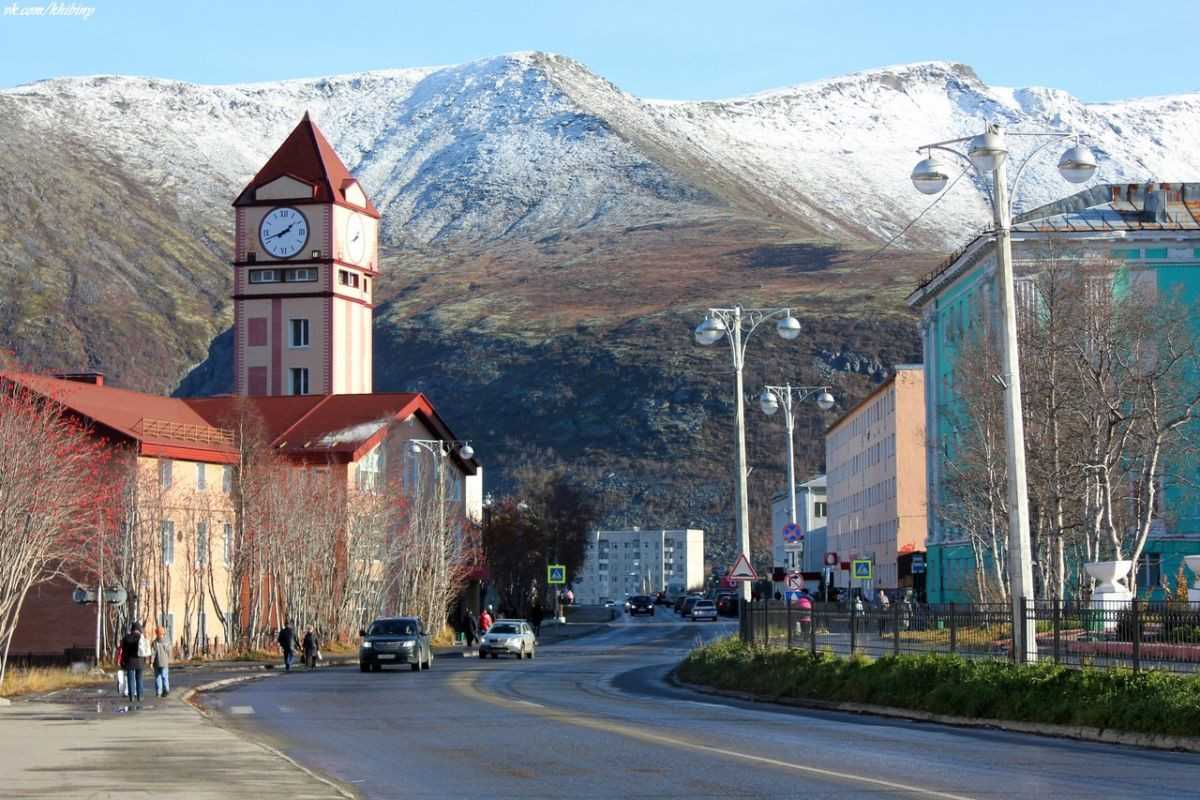
Life in the Northernmost Cities and Towns
Ny-Ålesund
The four northernmost towns are all located in Norway, the farthest of which is Ny-Ålesund in Svalbard, a Norwegian archipelago. Founded in 1917 as a coal mining town, today, it serves as a research base for around 35 people. Kings Bay, an office of the Norwegian Ministry of Trade and Industry, owns and operates the settlement making sure the infrastructure functions correctly. Most of the researchers focus on environmental and atmospheric issues. Their lives are confined to the settlement because roads only exist within its borders; their only option is to use snowmobiles.
Pyramiden
With an even smaller population, Pyramiden in Svalbard, Norway is the next most northern town. At any given time, between 4 and 15 people live here although it once had around 1,000 residents. Like Ny-Ålesund, this settlement was founded as a coal mining community and ownership changed hands in 1927 when it was sold to Russia (then-Soviet Union). Today it is owned by Arktikugol, a Russian coal mining company who employs the residents to perform maintenance and upkeep on the buildings.
Longyearbyen
The first town on the list with a significant population size is Longyearbyen in Svalbard, Norway. Around 2,075 people live here and enjoy educational services, churches, cultural facilities, transportation infrastructure, air service, and public safety services. This settlement also began as a coal mining town although mining operations have since nearly stopped. In the 1990’s, the locality went through a process to make it more like a traditional town rather than a mining company encampment. A significant percentage of residents, around 23%, moved away in the early 2000’s, presumably because of the difficulty of life so far north.
Barentsburg
The next town is also the last in Norway. Barentsburg in Svalbard has a population of 470. Russia and Norway operate mining endeavors here which was the reason for the town’s establishment in the 1920’s. Today, residents rely on Russia for food and currency. At times, Russia hasn’t sent sufficient food rations, and the neighbors in Longyearbyen have sent emergency help. The two settlements are close to each other but are not connected by roadways. To reach each other, people must go by boat, helicopter, or snowmobile. To say that life here is secluded would be an understatement.
Other Cities/Towns
Other towns and cities located in the northernmost parts of the world are all located in Greenland, Canada, and Russia. These countries are all known for their northern locations and arctic-like conditions. None of them has a population as large as Longyearbyen in Norway.
![When does summer start in 2023? [countdown]](https://asdisel.ru/wp-content/uploads/c/1/8/c189d9551444d014770dc224dcb7a0c5.jpeg)

Роза ветров в городе Кировск
Роза ветров в городе Кировск (её также называют рисунок направления ветров или карта ветров) показывает, какие ветры преобладают в рассматриваемом городе. В данном случае карта ветров показывает преобладающие направления ветров в городе Кировск.
Как видно из розы ветров, основным направлением ветра в городе Кировск является юго-западный (20%). Кроме того, преобладающими направлениями ветра можно назвать южный (20%) и западный (16%). Самый редкий ветер в городе Кировск — восточный (6%).
Дайте нам знать, полезен ли Вам этот график?Полезный график (6176)Нет (1174)
| Роза ветров в городе Кировск | ||
|---|---|---|
| Направление | Частота | |
| Северный | 8.2% | |
| Северо-восточный | 10.2% | |
| Восточный | 6.1% | |
| Юго-восточный | 11.1% | |
| Южный | 20.1% | |
| Юго-западный | 20.3% | |
| Западный | 15.6% | |
| Северо-западный | 8.5% |
Погода в различных городах в России на weatherarchive.ru:
| Погода в России в октябре | Погода в России в октябре 2023 года |
|---|---|
| АбаканАрхангельскАстраханьБарнаулБелгородБлаговещен..БрянскВеликий Но..ВладивостокВладикавказВладимирВолгоградВологдаВоронежГрозныйДонецкЕкатеринбу..ИвановоИжевскЙошкар-ОлаИркутскКазаньКалининградКалугаКемеровоКировКировКостромаКраснодарКрасноярскКурганКурскЛипецкМагнитогор..МайкопМахачкалаМоскваМурманскНабережные..НальчикНижневарто..Нижний Нов..Нижний Таг..НовокузнецкНовороссий..НовосибирскОмскОренбургПензаПермьПетрозавод..Петропавло..ПсковРостов-на-..РязаньСамараСанкт-Пете..СаранскСаратовСмоленскСочиСтавропольСургутСыктывкарТамбовТверьТольяттиТомскТулаТюменьУлан-УдэУльяновскУфаХабаровскЧебоксарыЧелябинскЧеркесскЧитаЭлистаЮжно-Сахал..ЯкутскЯрославль | АбаканАрхангельскАстраханьБарнаулБелгородБлаговещен..БрянскВеликий Но..ВладивостокВладикавказВладимирВолгоградВологдаВоронежГрозныйДонецкЕкатеринбу..ИвановоИжевскЙошкар-ОлаИркутскКазаньКалининградКалугаКемеровоКировКировКостромаКраснодарКрасноярскКурганКурскЛипецкМагнитогор..МайкопМахачкалаМоскваМурманскНабережные..НальчикНижневарто..Нижний Нов..Нижний Таг..НовокузнецкНовороссий..НовосибирскОмскОренбургПензаПермьПетрозавод..Петропавло..ПсковРостов-на-..РязаньСамараСанкт-Пете..СаранскСаратовСмоленскСочиСтавропольСургутСыктывкарТамбовТверьТольяттиТомскТулаТюменьУлан-УдэУльяновскУфаХабаровскЧебоксарыЧелябинскЧеркесскЧитаЭлистаЮжно-Сахал..ЯкутскЯрославль |
Солнце
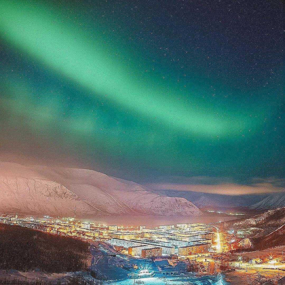
Из-за экстремальной широты в Кировск летом наступает полярный день (также известный как полуночное солнце), а зимой — полярная ночь. Это периоды времени, когда солнце непрерывно находится выше или ниже горизонта более одного дня. Точные даты начала и окончания полярного дня и ночи меняются от года к году и зависят от точного местоположения и высоты наблюдателя, а также от местной топографии.
Летом в Кировск на протяжении 2023 Солнце постоянно находится над горизонтом в течение 1,6 месяца, встав в 0:49 29 мая и снова зайдя только в 0:30 16 июля.
Зимой в Кировск на протяжении 2023 солнце постоянно находится под горизонтом в течение 2,3 недели, заходя в 12:43 14 декабря и снова вставая только в 12:35 30 декабря.
Количество часов дневного света и сумерек в Кировск
Количество часов дневного света и сумерек в Кировскянв.февр.мартапр.майиюньиюльавг.сент.окт.нояб.дек.0 ч.24 ч.4 ч.20 ч.8 ч.16 ч.12 ч.12 ч.16 ч.8 ч.20 ч.4 ч.24 ч.0 ч.12 ч. 14 мин.21 мар.12 ч. 14 мин.21 мар.24 ч. 0 мин.21 июн.24 ч. 0 мин.21 июн.12 ч. 24 мин.23 сент.12 ч. 24 мин.23 сент.0 мин.22 дек.0 мин.22 дек.ночьночьденьСейчасСейчас
Количество часов, в течение которых видно солнце (черная линия). Снизу (наиболее желтые) вверх (самые серые) цветные полосы обозначают: полный дневной свет, сумерки (гражданские, морские и астрономические) и полную ночь.
|
Летнее время в Кировск в 2023 не вводится.
Восход и закат с сумерками в Кировск
Восход и закат с сумерками в Кировскянв.февр.мартапр.майиюньиюльавг.сент.окт.нояб.дек.24681012141618202229 мая0:4929 мая0:490:3015 июл.0:3015 июл.12:4314 дек.12:4314 дек.деньночьночьночьночьАстрономическаяполночьАстрономическаяполночьАстрономическийполденьВосходЗакат
Солнечный день на протяжении 2023 года. Снизу вверх черные линии — это предыдущая солнечная полночь, восход солнца, солнечный полдень, закат и следующая солнечная полночь. День, сумерки (гражданские, морские и астрономические) и ночь обозначаются цветными полосами от желтого до серого.
На рисунке ниже представлено компактное представление высоты солнца (угол солнца над горизонтом) и азимута (его направление по компасу) для каждого часа каждого дня в отчетный период. Горизонтальная ось — это день года, а вертикальная ось — час дня. Для заданного дня и часа этого дня цвет фона указывает на азимут солнца в этот момент. Черные изолинии — контуры постоянной солнечной высоты.
Высота Солнца и азимут в Кировск
Высота Солнца и азимут в Кировскянв.февр.мартапр.майиюньиюльавг.сент.окт.нояб.дек.224466881010121214141616181820202222101010202020303040101020203040-146СейчасСейчас
севервостокюгзапад
Высота солнца и азимут на протяжении 2023 года Черные линии — это линии постоянной высоты солнца (угол солнца над горизонтом в градусах). Заливки фонового цвета указывают на азимут (направление по компасу) солнца. Слегка затемненные области на границах сторон света указывают подразумеваемые промежуточные направления (северо-восток, юго-восток, юго-запад и северо-запад).